Record‑Early Polar Vortex Split Forecast Signals Unprecedented Stratospheric Warming
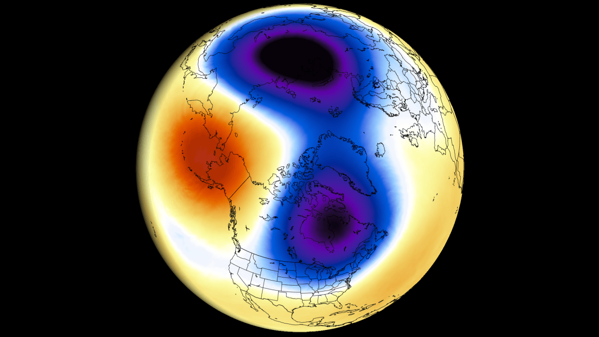
Models now show the Northern Hemisphere’s Polar Vortex could reverse and split in early November, setting a new record for Sudden Stratospheric Warming.
What the models are showing
Latest forecasts from the ECMWF and GFS models suggest that stratospheric winds around the polar circle will weaken, turn negative and possibly reverse in early November. The GEFS extended‑range model also approaches a reversal, though it predicts a rapid recovery afterward.
All three models dip below the historical minimum wind speed (shown as a dashed red line in the reference chart), indicating a disruption that would be unprecedented for this time of year.
Split of the Polar Vortex
At the 10 mb level (about 30 km/19 mi altitude), the ECMWF day‑10 forecast displays the Polar Vortex breaking into two separate cores while the outer shell remains linked. A high‑pressure anomaly over the North Pacific is driving this split, creating an anticyclone that spins clockwise and generates easterly (negative) zonal winds.
Temperature anomaly
The same ECMWF forecast shows a temperature wave that lifts stratospheric temperatures nearly 22 °C (40 °F) above the climatological norm at the mid‑stratosphere. This warming constitutes a Sudden Stratospheric Warming (SSW) event and would be the earliest on record, beating the previous earliest by at least three weeks.
Potential surface impacts
Although the event is still early in the season, model output already hints at indirect effects. Cooler trends are projected to develop over parts of Europe and the eastern United States in the coming weeks.
How the Polar Vortex works
The Polar Vortex is a large‑scale winter circulation that extends from the surface up through the stratosphere. When it is strong and stable, it acts as a barrier that keeps the coldest Arctic air near the pole, giving milder conditions to mid‑latitude regions. A disruption—often triggered by a rise in stratospheric pressure and temperature—breaks this barrier and can allow Arctic air to spill southward.
Long‑range outlook
Long‑range data point to an even stronger disruption later in the 2026/2027 winter season, suggesting that the early November event could be the first of a series of significant stratospheric changes.
Key points
Earliest SSW on record: Expected in early November, at least three weeks earlier than any previous event.
Wind reversal and split: Models show a reversal of stratospheric winds and a split of the Polar Vortex into two cores.
Temperature spike: Stratospheric temperatures could rise up to 22 °C (40 °F) above normal at the 10 mb level.
Possible downstream cooling: Early forecasts indicate cooler trends over parts of Europe and the eastern United States.